| ||||||||||
|
|
Journals 2005/2006Susan Holt
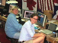
May 22, 2005 Once again, it is an absolutely beautiful day. Our latitude and longitude is 4o and 94o.There are puffy clouds in the sky and it is hot and humid. When I got up this morning, they had taken the ROV out of the water and put in the seismic equipment around 4:00 am. When the air guns fire, it causes a compression wave to move through the water, which hits the ocean floor, then bounces back up to the hydrophones. It is much like how an echo works when you yell into a canyon and hear your voice returning to you. When the hydrophones pick up the signal, it is recorded as a series of lines that can show the structure of the ocean floor layer by layer. It allows scientists to see where faults are and even where sediment is layering between the uprising ground. David Mosher has taken this data and manipulated it so it can be seen on the screen as a 3-dimensional figure. Roland Arsenault showed me how he is taking a series of photos and making them into a mosaic. When the ROV is down, pictures are taken of a large feature and then the pictures are pieced together into one big picture. Roland wrote a program that puts points on each picture and then he moves the points with the mouse until the points line up with the previous picture. It sounds easy but it is not at all! It takes many patient hours of work to make the details line up, especially if the pictures are not of the same scale. To make matters even more complicated, he is taking the video that was shot at the same site and adding the pictures from the video to make an even larger "mosaic."
Larry Mayer was showing his computer image of the tsunami to the camera crew today. He has a joystick attached to his computer where he controls the view moving in any direction. For example, hw can show the height of the tsunami waves in comparison to the land area around the Indian Ocean. The technology that is happening on this expedition is unbelievable.
| |||||||||