| |||||||||||
|
|
Journals 2009/2010Beth Brocato
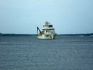
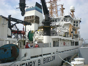
September 9, 2009 Coordinates: 41°31.836' N, 71°18.810' W After working my way over the Jamestown and Newport bridges, and navigating my way through the Newport Naval Base, I finally found Pier 2 at the requested time of 8:30 a.m. This is where the NOAA (National Oceanic and Atmospheric Administration) research ship, Henry BBigelowis to leave from. Also waiting on shore are a few other volunteers and research scientists from Woods Hole Oceanographic Institute (WHOI) in Cape Cod, MA.
We can see theBigelowin the bay; she has yet to dock. I realize it is time to put on my seasickness patch...just in case. By 10 a.m. she has finally docked and we are welcomed aboard. Each person is given a cabin and a roommate. I'll introduce you to Stephanie later. We spend time making our bunks and storing our belongings. It is at this time we hear some grumblings about not leaving on time. By 11:00 a.m. we get the word that the ship will not be leaving until 16:00 tomorrow (Thursday). Apparently there are a couple of storms in the ocean that the crew are not crazy about navigating through. So, while we are still in port we will wait it out. Those that are from out of town will spend the night on the ship. Since I live close, I will mosey on home and try again tomorrow. Hopefully my seasickness patch will still work. :) QUESTION: 1. What does NOAA stand for? |
||||||||||