| |||||||||||||||||||||||
|
|
Journals 2008/2009Roy Arezzo
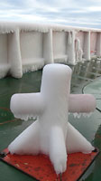
July 30, 2008 Today was all transit and we are still looking for an appropriate sample site. Before I went to sleep the winds were over 40 knots and the wind chill had plummeted to -30° C. The entire back deck is coated in ice from the waves crashing over the rail and freezing. The equipment will need to be freed from the ice before we begin sampling. Unfortunately it is not clear when that will be.
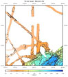
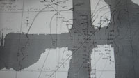
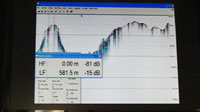
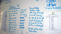
Station N, for north, emerged as the wining label for the new station. When we arrived in the vicinity of Station N, the ship zigzagged north to survey the bottom. We found what was we thought was a suitable transect area from multi-beam sonar information, and sent down a video camera to confirm our observations. From the video images we learned the area was too rocky for our study. It is possible that the currents between the islands are sweeping the sediment east, exposing more rock. We are continuing northeast, towards Elephant Island, to an area Dr. Rhian Waller had been in May 2008, collecting deep water corals. The good news is we have spent many hours collecting good information about the seafloor bottom, the bad news that we are still looking for a soft flat bottom on the continental shelf to do some more sampling. Bathymetric sonar is a navigational aid that ships typically use to measure depth. Dr. Dave explained how to assess the make up of the seafloor by viewing the bathymetric sonar image on the monitor. If a thin distinct bottom profile line is visible on the screen it is probable that the sonar is reflecting off a hard surface like stone. With a softer bottom of sediment, the sonar penetrates deeper into the seabed. This shows up on the sonar screen as textured, thick band. We are able to get a more detailed picture of the seafloor by looking at multi-beam sonar data. The NBP has the capacity to use multi-beam but we are not running it on this cruise. The Ratheon Polar Services home office in Denver was able to send some older images to us for the regions we expressed interest in. This technology uses a series of sonar beams to get a wide swatch of the area below the ship; the resulting data is processed through special software that generates contoured seafloor maps. All the work is falling on the Principal Investigators and the mates in the bridge as they chart possible locations for us to explore. The rest of us are on hold, waiting to be on station.
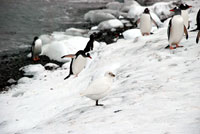
We are still basking in the excitement of the trip to King George Island yesterday, and the importance of the excursion is still sinking in. Looking at the sea from the land seems to emphasize the connection between them. The Antarctic food web is more complex than I had ever imagined: benthic, pelagic and shoreline communities all rely on each other for sustenance. Looking beyond the scenic views and thinking about why we are out here in the first place reignites my interest to study and conserve this fragile ecosystem, which can be impacted by places so far away.
|
||||||||||||||||||||||